


Update Friday 1/5/2024
Time to make sure cars have full tanks. Check your home fuel levels. Have flashlights/lanterns and extra batteries on hand. Double check snowblowers. This will be a plowable snow. If you go out to shovel, please pace yourself, ask others for assistance and remember dehydration does occur in the winter as well, so stay hydrated. Unless it is an emergency please adhere to the Governor’s and State Police request to stay off the roads. Curl up with a good book and just use the storm as a great opportunity to relax for the evening.
STATUS OF THE STATE EMERGENCY OPERATIONS CENTER: MONITORING
LARGEST WINTER STORM IN ALMOST 2 YEARS EXPECTED TO BRING MODERATE TO HEAVY SNOW TO OUR AREA SATURDAY NIGHT AND INTO THE DAY ON SUNDAY…WINTER STORM WATCHES HAVE BEEN ISSUED BY THE NWS FOR MOST OF CONNECTICUT EXCEPT ALONG THE COAST…
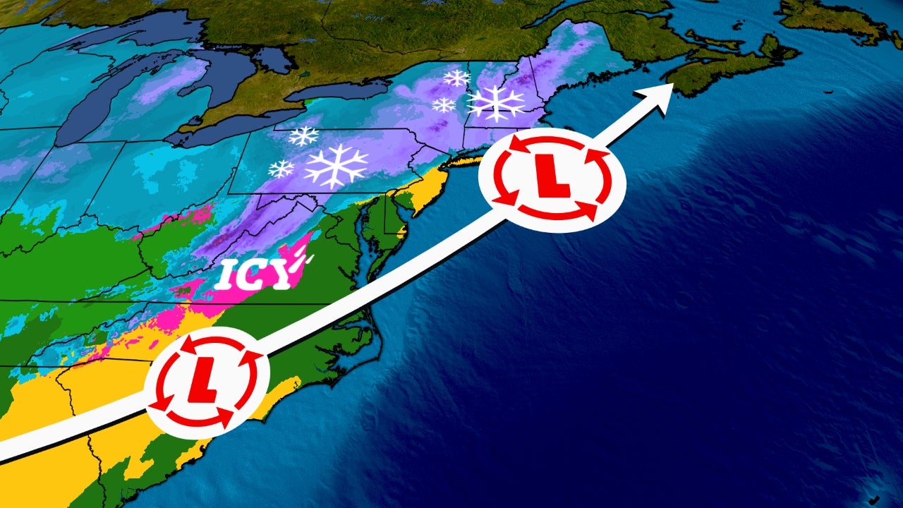
The EURO, GFS and NAM computer models are currently in good agreement and are forecasting that a low-pressure system currently located over Texas will move across the southern U.S. over the next 24 hours to a position near the North Carolina coast by Saturday afternoon. This low is then forecast to gradually intensify as the storm moves just south of New England Saturday night and during the day on Sunday. This will likely be the largest snowfall since February 1, 2022 when 11.7” fell at Bradley and 15.2” fell at Bridgeport. The following forecast is based on a blend of the EURO, GFS and NAM models:
Saturday Evening and Overnight: Light snow mixed with rain at the coast is expected to spread into the state from the southwest between 4:00 – 7:00 pm. The snow is forecast to quickly pick up in intensity and become moderate to heavy at times (snowfall rates up to 1” per hour) by 9:00 PM. A period of heavy snow may occur between 9:00 PM – 3:00 AM with snowfall rates between 1.0” – 1.25” inches per hour across most of the state. The snow intensity may lighten somewhat after 3:00 AM with some rain mixing in along the coast. Temperatures are forecast to be in the low 30’s with northeast winds at 15 – 25 MPH gusting to 35 MPH at times along the coast. The impact on overnight travel is expected to be moderate with several inches of snow cover on most roads across the state overnight.
Sunday: Moderate snow continuing during the day in central and northern CT with snowfall rates around ½” per hour. Wet snow mixed with rain is expected in southern CT during the morning with a change back to all wet snow by noon. Highs holding in the low 30’s with a northeast wind gusting to 30 MPH at times along the coast. The snow is expected to taper off by mid to late Sunday afternoon. The impact on travel is expected to be minor to moderate across most of the state with the highest impacts in the NW and NE hills with a few inches of snow cover on many roads. Total snow accumulations are currently forecast to range from 3” – 6” along the coast, 6” – 10” across most of the state and 10” – 14” in the NW and NE hills because the snow should be dryer above 1,000 feet.
The Department of Emergency Services and Public Protection, Division of Emergency Management and Homeland Security will continue to closely monitor this approaching winter storm.
The next update will be sent out at Noon on Saturday.
1/5/2024 – Winter Storm Warning Issued From Sat 4 pm until Sun 7 pm EST
1/4/2024 – Please see the attached in reference to the upcoming winter storm below.