LONG DURATION MIXED RAIN/SLEET/WET SNOW EVENT STILL EXPECTED ON FRIDAY…WINTER WEATHER ADVISORIES ISSUED FOR THE ENTIRE STATE…
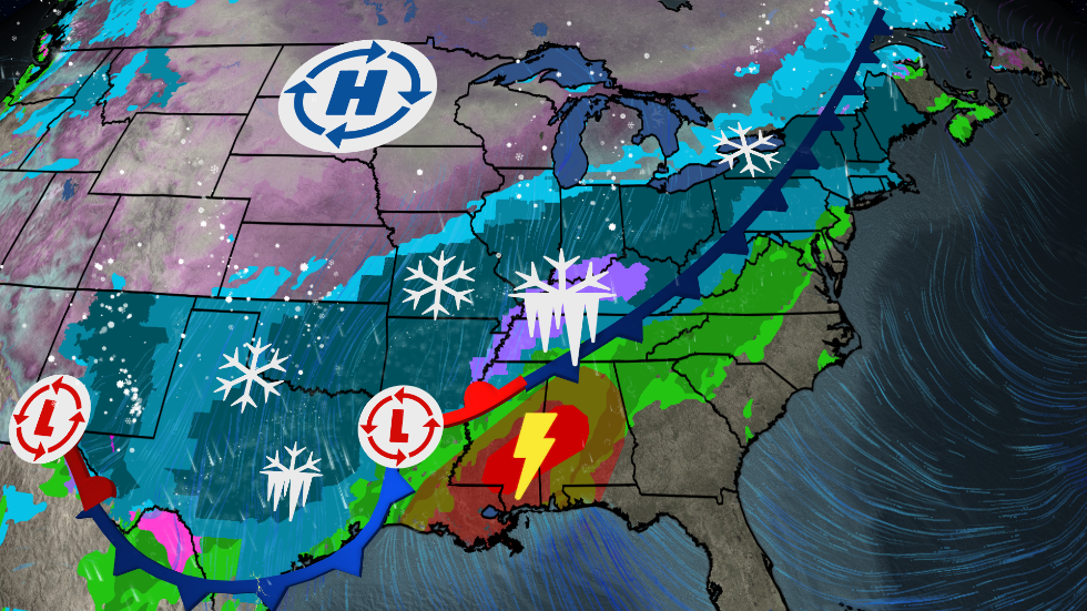
A slow moving cold front is forecast to move across our area on Friday. As this front moves from northwest to southeast across the state a low pressure system is forecast to move along the front coming up from the Washington D.C. area into southern New England Friday morning. Temperatures very early Friday morning are forecast to be in the upper 30’s, but are expected to fall to near freezing just after daybreak on Friday. Here’s the latest forecast based on the current GFS and NAM models:
Friday Morning: Rain, moderate at times is forecast to change to a mix of sleet and freezing rain in the NW hills by 5:00 AM. In the Danbury and Hartford areas the rain is forecast to change over to sleet between 6:00 – 8:00 AM. Plain rain is expected along the coast and in southeastern CT. Most roads should be wet with a thin coating of sleet on the shoulders and a minor impact for the morning rush hour. Temperatures in central CT are forecast to drop from the upper 30’s before daybreak down to near freezing by 7:00 AM.
Friday Afternoon: Sleet and freezing rain in the NW hills is forecast to change to wet snow by mid afternoon. Sleet in central CT is forecast to continue thru the early afternoon with rain in southeastern CT. Temperatures are forecast to drop into the mid 20’s in central CT and near 30 F at the coast. Some of the wet snow and sleet may start sticking to any untreated roads by early afternoon especially in the NW hills and central CT. The precipitation is now forecast to end by mid afternoon, however, a flash freeze with widespread black ice is possible on roads where the treatment was washed away by earlier rainfall. A minor to moderate impact on the afternoon rush hours is possible with widespread black ice.
Friday Evening: Additional areas of black ice can be expected to develop as temperatures fall into the low 20’s.
Note: Some glazing from freezing rain (around 1/10th inch) is also possible in the NW hills, however significant icing is not expected.


