At a Glance
-
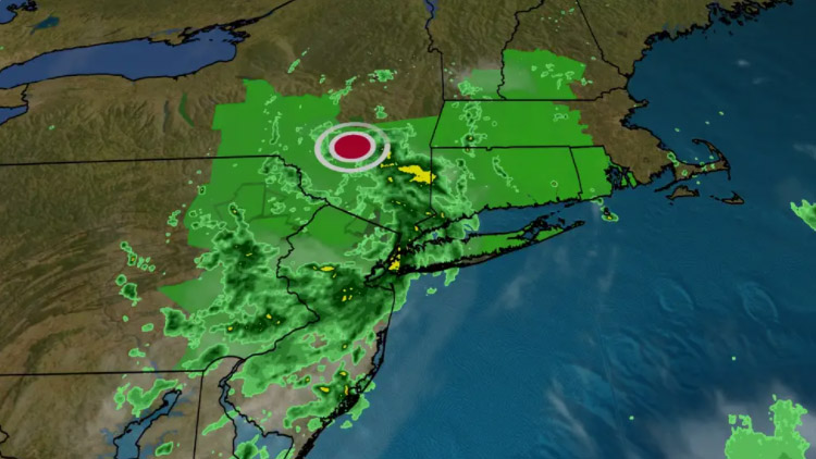
8/23 6 PM – Henri could bring more locally heavy rain and possible flooding to parts of the Northwest CT on Monday as the system continues to wind down.
- 8/22 4 PM – Henri is ‘losing its punch’ after making landfall in Rhode Island. A tropical storm warning is still in effect across North West CT with more heavy rain likely still on the way.
- 8/22 1:15 PM – Henri Moves Onshore, Center of Storm Now Expected to Pass-Through Central and parts of NWCT
- 8/22 1 PM – Herni made land landfall in Rhode Island at around 1 PM.
- 8/22 11 AM – Henri’s track shifts again and could stall over NWCT – After shifting east overnight, the latest forecast as of 11 AM shows it is expected to make landfall in Rhode Island before moving west across Connecticut and potentially stalling along the Connecticut-New York border in the evening
- 8/22 8 AM – Henri downgraded to tropical storm — threat of wind, rain continues in CT
-
8/22 6 AM – Hurricane Henri is roughly 90 miles south of Point Judith, RI, and moving north at 18mph. Overnight the track did trend further east, putting a landfall closer to the RI coast. The shift east is a good thing for us here in NW Corner but we will still receive torrential rain, flooding, and strong winds. Stay safe everyone!
- 8/21 3 PM – Henri has become a Category 1 hurricane and will track toward the Northeast, likely making landfall on Long Island or southern New England near hurricane strength late Sunday.
- 8/21 2 PM – Henri has strengthened into a hurricane.
- 8/21 7 AM – Tropical Storm Henri is continuing its path towards Connecticut Saturday morning.
- 8/21 – A Tropical Storm Warning has been issued for Northwest CT.
- 8/20 – Gov. Ned Lamont issued a state of emergency Friday and activated the National Guard to help with search and rescue, clearing routes, power generation, and distributing supplies after the storm.
- 8/19 – Henri is strengthening and is expected to become a hurricane Saturday.
- 8/19 – Henri will likely track over parts of CT late weekend into early next week.


